JRJ Construction New Headquarters
Baseline construction documentation for a new headquarters building, including orthomosaic, elevation model, and volumetric stockpile analysis.
830
Images Captured
9.67 acres
Site Area
0.4 in/px
Ortho Resolution
0.1 ft RMSE
Positional Accuracy
6
Stockpiles Measured
Project Overview
The Full Story
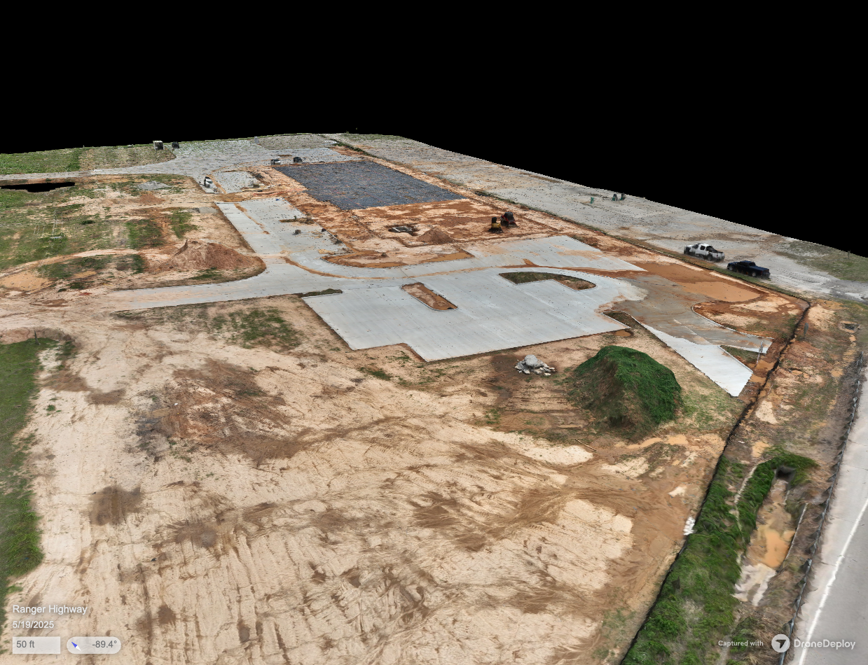
In 2025, JRJ Construction broke ground on a new headquarters building in Weatherford, Texas. LittleBird was able to document the early construction site conditions, establishing a comprehensive aerial baseline that would serve as a foundation for ongoing progress tracking.
A grid-pattern flight was executed capturing both nadir and oblique imagery of the 9.67-acre site. The 830 images were processed into a full suite of photogrammetric products including an orthomosaic, 3D model, point cloud, elevation model, and digital terrain model, all with RTK-corrected positioning achieving an exceptional 0.1-foot RMSE.
A volumetric stockpile analysis was also performed, identifying and measuring six material stockpiles across the site. Each stockpile was classified by material type (dirt or clay) and measured for volume, mass, and estimated value. All data was delivered through DroneDeploy with full download access for GeoTIFF, contour, and raw elevation formats.
Visit JRJinc.com to learn more about the impact this company is making not just in their community, but across the state and beyond.
0.1-foot positional accuracy across a 9.67-acre site with volumetric stockpile analysis totaling 489.64 yd³ of measured material.
Equipment
Project Media
See the Work
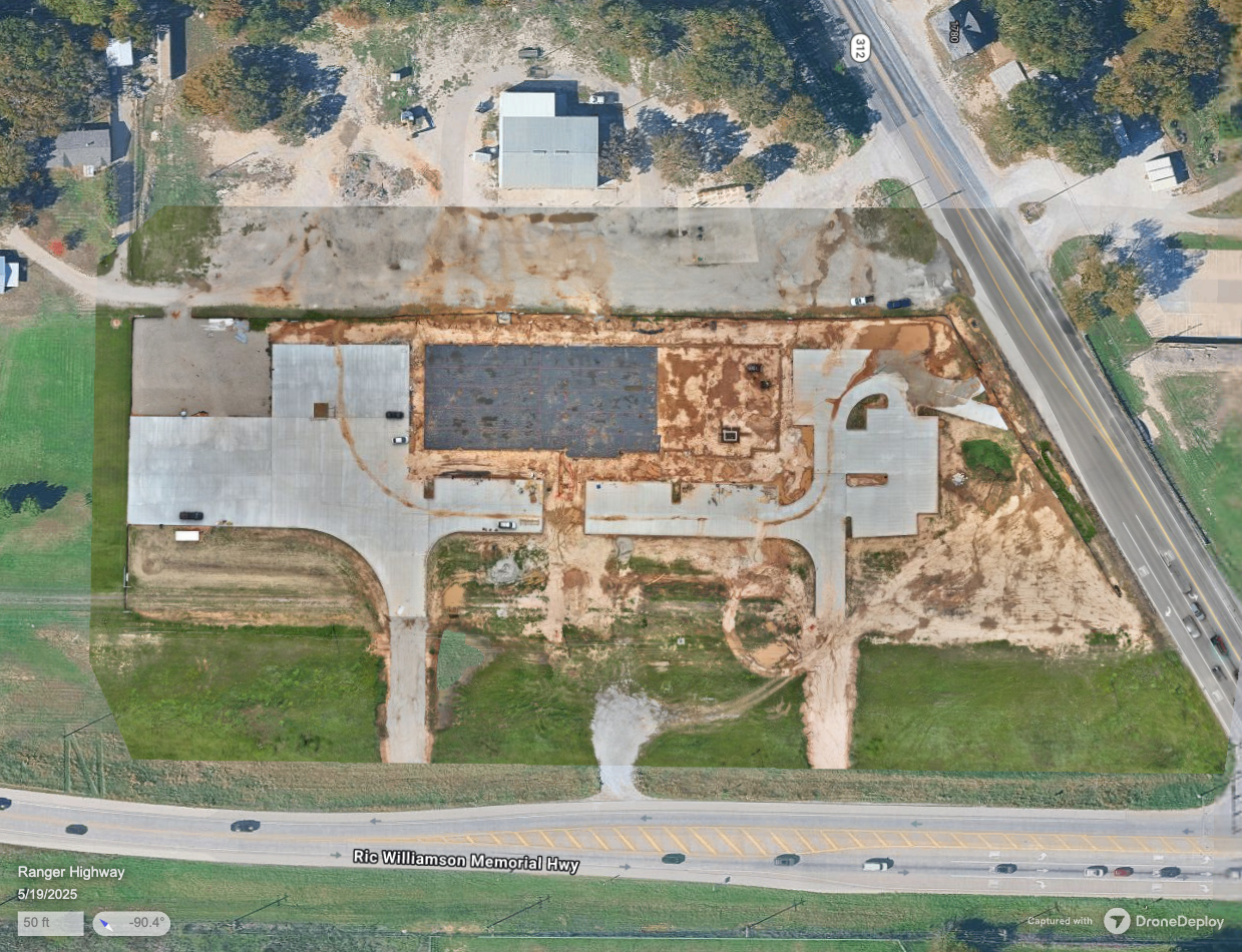
Comparison of the site map overlay with the high-resolution orthomosaic captured at 0.4 in/px ground sample distance.
What We Delivered
Project Deliverables
Every engagement produces tangible, documented outputs your team can use to take action.
RGB Orthomosaic & 3D Model
High-resolution site ortho at 0.4 in/px with 3D model, downloadable in GeoTIFF (816 MB), JPG, and PDF formats.
Elevation Model
Digital elevation data at 1.47 in/px resolution with contour exports in DXF and SHP formats for CAD integration.
Stockpile Analysis
Volumetric measurement of six material stockpiles with classification, volume, mass, and estimated value for each.
DroneDeploy Project Hub
Centralized access to all models, imagery, and analysis with viewer and download capabilities for stakeholders.
More Projects
Explore Other Case Studies
Ball High School North Campus
19 months of precision aerial documentation capturing a brand-new school from bare dirt to completion. 108 flights, 28,457 images, and transparent deliverables serving the consultant, stakeholders, and the Galveston community.
Texas A&M University Student Housing
Comprehensive facade and thermal roof assessment of a 10.1-acre, 3-building student housing complex at Texas A&M University. 41 flights and 13,000+ images captured in the active landing path of Easterwood Airport after six weeks of multi-agency airspace coordination.
Your Project Could Be Next
Tell us about your building or site and we'll show you what's possible.