Construction Progress Monitoring
Verified progress. Visual proof. Complete documentation.
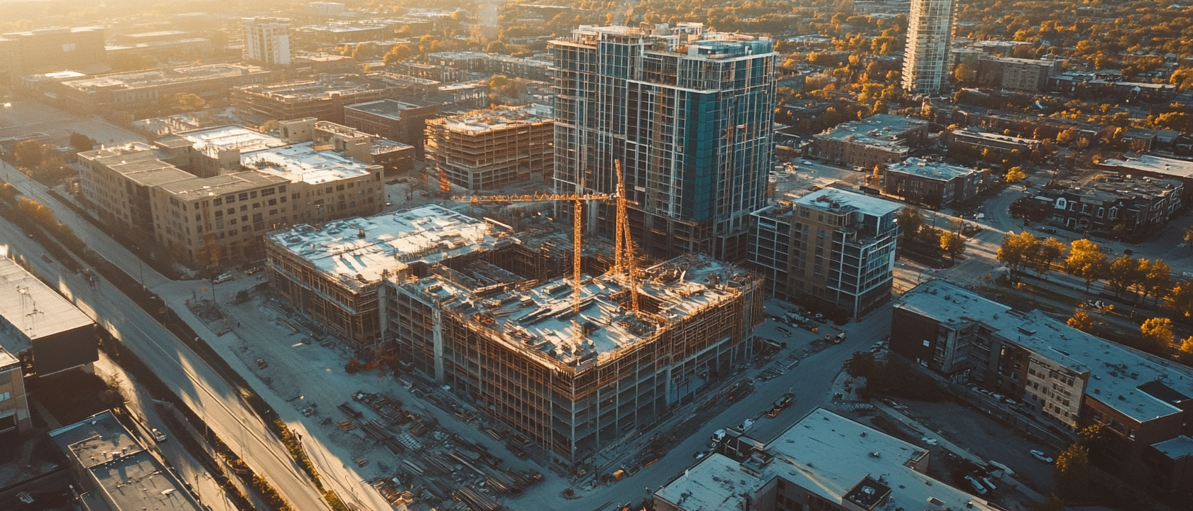
Comprehensive construction documentation combining scheduled aerial drone surveys with ground-based interior capture using 360° cameras. This dual approach provides complete site coverage: overhead and oblique aerials for exteriors, site layout, and earthwork, plus immersive 360° interior walkthroughs that document MEP rough-ins, framing, finishes, and every phase in between.
The Challenge
Problems You Might Be Facing
These are the real-world issues our clients come to us with. If any of this sounds familiar, you're not alone.
Stakeholders lack visual verification of progress
Project owners, lenders, and investors rely on written progress reports that are difficult to verify. Without consistent visual documentation, trust erodes and disputes arise.
Disputes over timelines and completion percentages
Disagreements about what's been completed, when milestones were reached, and whether work meets expectations become costly without an objective visual record.
Coordination gaps between trades go undetected
Without regular overhead and interior documentation, scheduling conflicts, out-of-sequence work, and trade coordination issues aren't caught until they cause delays or rework.
Interior conditions get covered up permanently
MEP rough-ins, framing, waterproofing, and other concealed work are impossible to inspect once drywall goes up. Without documentation, warranty and litigation claims have no evidence.
No consistent visual record for the project lifecycle
Without a systematic approach to documentation, there's no reliable baseline to compare against, no archival record, and no time-lapse perspective on site evolution.
Safety monitoring from the ground has blind spots
Large construction sites have hazards that are invisible from ground level. Aerial perspectives reveal safety concerns, material staging issues, and site organization problems.
How It Works
Our Proven Process
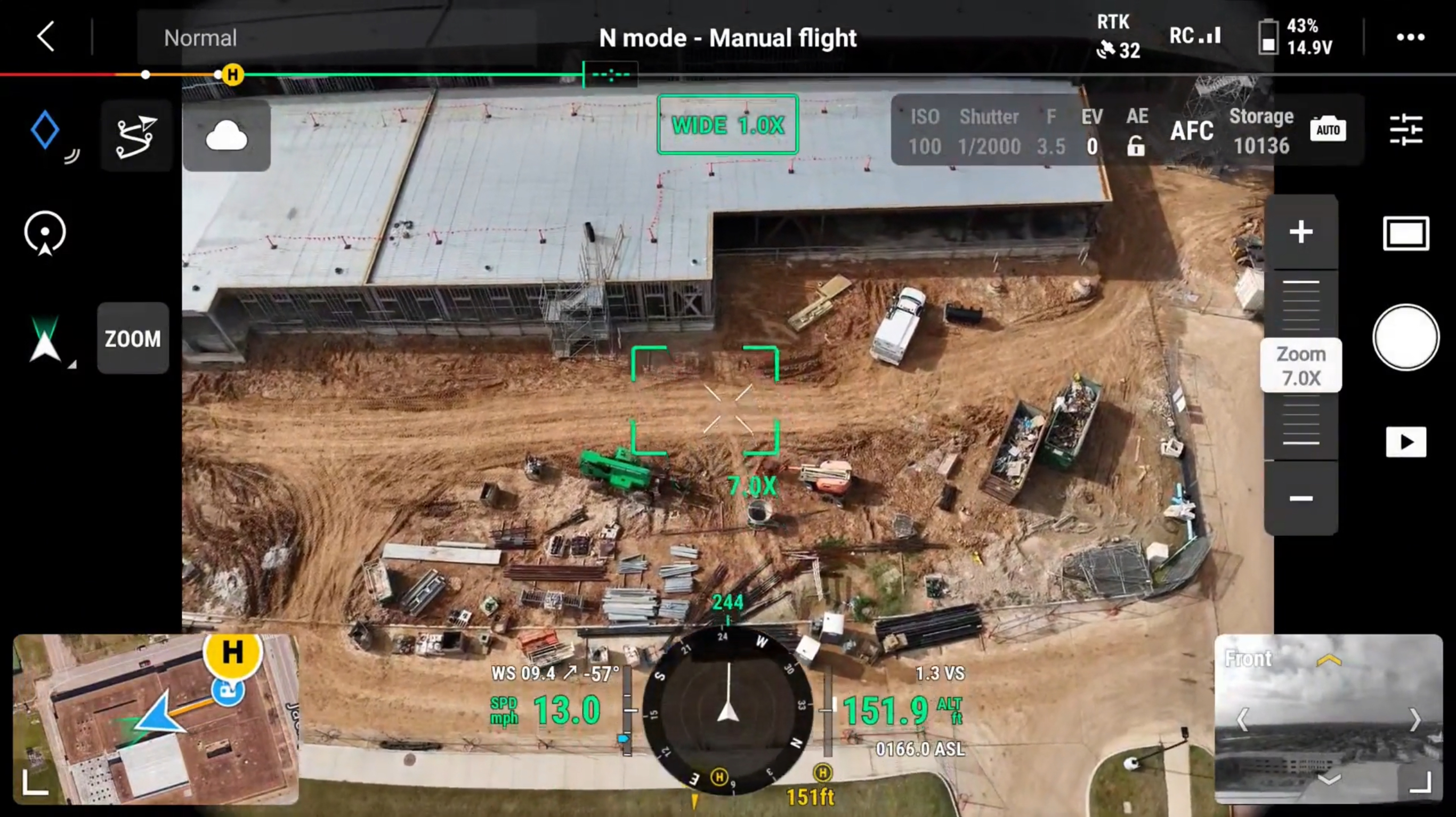
We establish a documentation schedule aligned with your project milestones. On each visit, we capture aerial surveys from consistent flight paths plus 360° interior walkthroughs of active areas. Data is processed and delivered within 48 hours, building a cumulative visual archive from first shovel to final punch list.
Consistent aerial documentation from the same vantage point on every visit, creating a true visual timeline of progress.
What You Get
Deliverables That Drive Decisions
Clarity at Every Stage. Confidence Long After.
Dated Aerial Photography Sets
Consistent, repeatable aerial coverage from the same angles on every visit, creating a true visual timeline of the project from pre-construction through closeout.
Orthomosaic Site Maps
Stitched, georeferenced overhead maps of the full site with measurement capabilities for tracking earthwork, material staging, and structural progress.
360° Interior Walkthroughs
Immersive, navigable interior captures that let remote stakeholders virtually walk through the building and inspect conditions at every phase.
Progress Comparison Overlays
Time-lapse sequences and side-by-side overlays that clearly show what changed between documentation visits, supporting milestone verification.
Volumetric Measurements
Precise cut/fill calculations, stockpile measurements, and earthwork quantification derived from photogrammetric site models.
Shareable Visual Reports
Professional reports formatted for stakeholder distribution, with annotated imagery, progress summaries, and archival documentation of concealed conditions.
Built for the People Who Need It Most
Our construction progress monitoring service is designed for professionals who need reliable, documented data to make critical decisions about their buildings and projects.
Explore More
Other Services You Might Need
Ready to Get Started?
Tell us about your project and we'll put together a tailored scope and quote. No pressure, no obligation.